


Vantage Aerial, LLC
Based in Minooka, IL
Stay ahead of your projects with up-to-date, high-resolution aerial imagery that far surpasses the outdated visuals from Google Earth. Our 2D mapping solutions provide you with clear, accurate progress updates on your job sites, helping you make informed decisions with real-time insights.With a comprehensive aerial perspective, you can efficiently plan, monitor, and manage your projects—enhancing accuracy and reducing costly errors. Whether you're in construction, surveying, or site management, our mapping services give you the vantage point needed to succeed.
Use the slider below to compare Google Earth imagery with Vantage Aerial's high-resolution 2D Orthomosaic Map


Streamline your planning and design processes with our cutting-edge 3D photogrammetry mapping solutions. Our highly detailed and accurate 3D maps provide real-time, actionable data, giving you a comprehensive view of your project without the need for on-site visits.Save valuable time and keep your projects on schedule by making informed decisions from anywhere. Whether you’re managing construction, surveying, or infrastructure development, Vantage Aerial’s 3D mapping technology ensures precision and efficiency every step of the way.
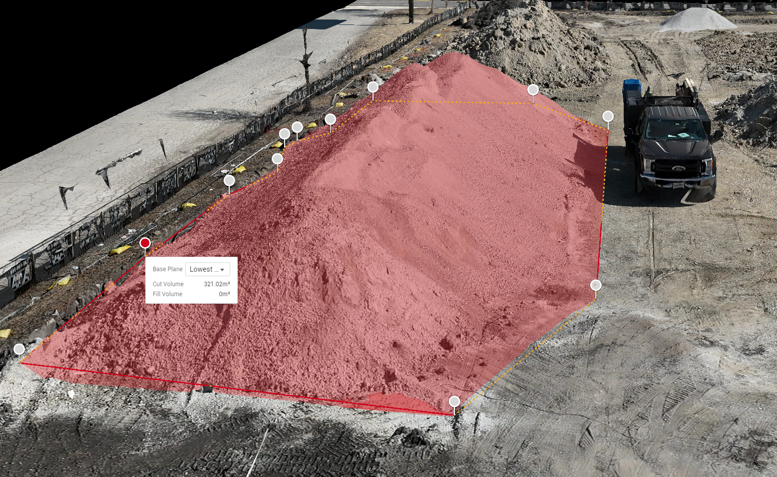

Accurately measure material stockpiles and track landscape changes over time with Vantage Aerial’s advanced volumetric services. Our state-of-the-art drone technology provides precise data to help you calculate the exact volume of materials, ensuring you know just how many trucks are needed to haul your load.Monitor erosion, assess site changes, and manage inventory with ease—all while eliminating the risks and inefficiencies of traditional measurement methods. Save valuable time and gain confidence in your data with safe, quick, and reliable volumetric solutions from Vantage Aerial.
Based in Minooka, IL
© 2025 Vantage Aerial, LLC. All Rights Reserved.